Have you noticed how windy it’s been lately? That’s because May and June is tornado season. And if we want to be prepared for anything, we need to know how to recognize and handle the giant gusts of destruction.
The National Severe Weather Storm Laboratory has information on how you can identify and classify a tornado. If you can see the issue before it starts, you can prepare for the worst ahead of time.
Tornadoes are most common in areas of large open geography. Ohio and Utah are two common examples. This allows wind to accumulate uninterrupted, resulting in stronger winds and easier tornado formations. With the changing seasons, May and June often have more rainstorms and strong winds. That’s why this is considered tornado season.
How Tornados Form
Believe it or not, the official stance is “we don’t fully understand.” We know that they are part of supercells, a type of rotating thunderstorm. The current theory is that temperature differences at the downdraft of a mesocyclone encourage the formation of a tornado, though certain scientists propose that this isn’t the case.
Identifying Tornado signs.
There are a few things that people can look for when trying to see if a tornado is coming. While these things can be present on their own, it’s when they are all together that you should be worried.
- Inflow Bands: Bands of low floating cumulus clouds extending from the main storm. This implies that the storm is gathering low-level air. And should you see them in a spiral motion, it’s a sign of cyclone development.
- Beaver’s Tail: Look for a smooth, flat cloud extending from the rain-free base of the storm. I usually found on the southern edge and is another sign of cycloning.
- Wall Cloud: an isolated cloud attached to the eye of the storm. It might rotate and has strong surface winds following below it. These usually exist for about 20 minutes before a tornado appears.
- Condensed Cold Air: this appears near the rain-free base of the storm. It helps form the wall cloud.
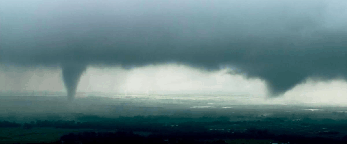
- Funnel Cloud: A cone-shaped cloud formation at the center of the storm. This is a tornado starting to develop. It’s technically not a tornado until the funnel touches the ground.
Normally, by the time it’s a funnel cloud, You’re already too late. If you cannot evacuate to a place outside of the storm, then you should find safety in your local storm shelter, underground, or in/around plumbing systems. A common suggestion is to wait in your bathtub, due to the plumbings connection to the earth.